| ENGINEERING SURVEY |
ENGINEERING AND GEOLOGICAL SURVEY | |||||
DBN-A.2.1-1-2014UA | |||||
Determine the boundary of the top layer of hard soil | |||||
Determine the boundaries between layers and states in hard soil and dispersed rock and establish a profile | |||||
Determine the position, depth, and shape of local unevenness: • Fractures and tectonic fracture zones; • Karst caves and underground tunnels. | |||||
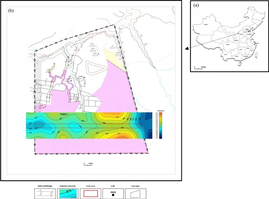
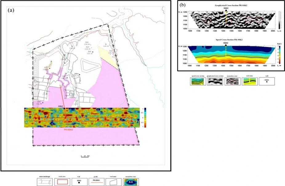
Study of engineering geological processes and their changes: 1) Stress state of the plot. 2) landslide: • Determine the condition of landslides and original soil; • Identification of weak areas and cracks; • Determine the compression and expansion areas of landslide collapse tongue and slope areas; • Determine the geometry of the sliding surface. 3) Karst: • Establish profiles to determine water content and cracks; • Study of soluble rock layer boundaries; • Determination of soluble rock layer thickness; • Identify and identify cracks, voids and holes in the thickness of soluble rock layers; • Study of fractured karst water and impermeable layers; | |||||
HYDROGEOLOGICAL SURVEY | |||||
Determining the migration path of fractured groundwater | |||||
GEOTECHNICAL SURVEY | |||||
Evaluation of stress and deformation of buildings and structures | |||||
Study on soil condition and characteristics | |||||
Fracture and stress state of target body | |||||
Find the infiltration path of dams such as dams | |||||
Identification of deformation zones of linear structures: tunnels, drainage pipes, pressure lines and oil and gas pipelines | |||||
Diagnose the stability of ancient historical sites and buildings, find underground passages and tombs | |||||
Identify and monitor high water surges, impact ore pressure (rock burst) and gas prone areas in mining roadways | |||||
Exploration of shallow and deep geothermal resources | |||||
  | |||||
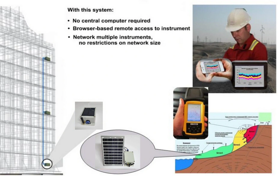
| THE SYSTEM CONTROL OF HAZARDOUS GEODYNAMIC EVENTS | |||||
 |